While the Atlantic hurricane season doesn't *officially* start until June 1st, there may be a tropical (or subtropical) system brewing off the Southeast coast. The only difference between the two is that tropical systems have tropical characteristics (warm-core, energy comes from warm sea surface temperatures) while subtropical systems have a combination of tropical and non-tropical characteristics (energy comes from temperature contrasts between air masses).
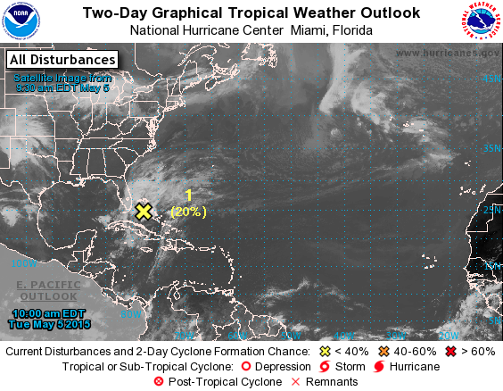
Below is the graphical tropical weather outlook from the National Hurricane Center (NHC). The satellite image show the area of cloud cover off the East coast of Florida - that is our area of disturbance highlighted by the NHC. It is forecasted to move north as the week progresses. The NHC anticipates an area of low pressure forming associated with this disturbance over the next day or so. There is a 20% chance of formation within the next 48 hours and a 40% chance of formation within the next 5 days.
Below is the graphical tropical weather outlook from the National Hurricane Center (NHC). The satellite image show the area of cloud cover off the East coast of Florida - that is our area of disturbance highlighted by the NHC. It is forecasted to move north as the week progresses. The NHC anticipates an area of low pressure forming associated with this disturbance over the next day or so. There is a 20% chance of formation within the next 48 hours and a 40% chance of formation within the next 5 days.
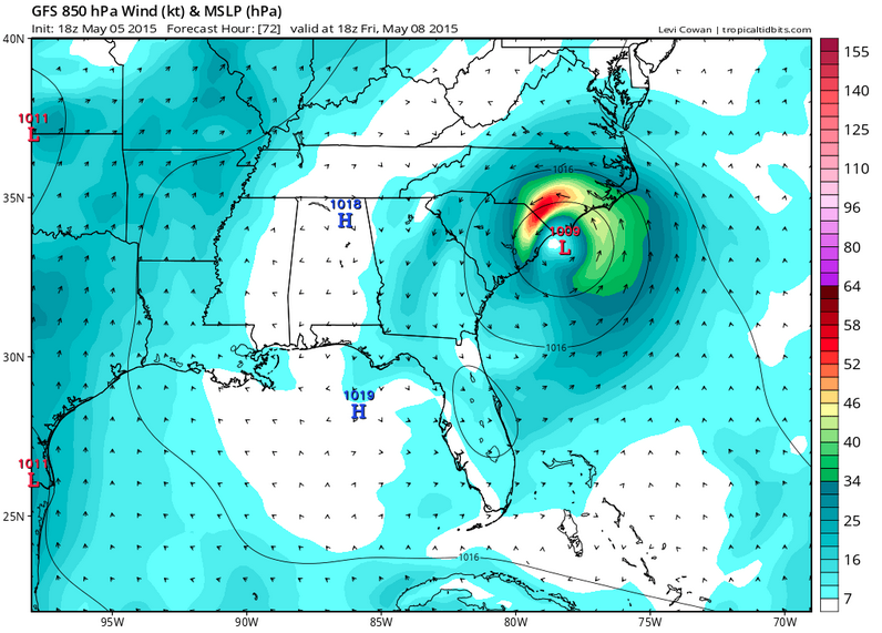
The image below depicts what the GFS model is forecasting in terms of the development of this system. By Friday afternoon, it shows an area of low pressure impacting the Carolinas. It is important to note that this is what one model is predicting and not a definitive forecast.
If this system meets the criteria set by the NHC as a tropical or subtropical storm, it will assign the first name of the season to it, Ana.
-Katie
-Katie
 RSS Feed
